
|
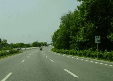
This 2002 photo shows the westbound RI 138 Expressway leaving Conanicut Island on the approach to the Jamestown-Verrazano Bridge. (Photo by Jim K. Georges.) |
||
|
A PROVIDENCE BYPASS ACROSS NARRAGANSETT BAY: The need for a Providence bypass across Narragansett Bay had been studied since the 1930's, and this gained momentum after the completion of the original Jamestown Bridge across the West Passage in 1940. However, it was only after World War II when the state accelerated its studies for bridges and approach highways. The first serious plan appeared in 1953 when a coalition of Rhode Island, Massachusetts, Connecticut, and New York officials proposed the "Cape Cod Expressway," a 260-mile-long toll road from New York City to Provincetown. The planned route across Narragansett Bay--which was to parallel the existing Route 138--was designed to not only bypass Providence, but also provide improved access to recreational areas and military installations. |
||
|
The dawn of the Interstate highway system in 1956 killed plans for the turnpike, but much of the route was part as I-95, I-195, and US 6. The only major component of the proposed expressway that was not built was the section through eastern Washington County and Aquidneck Island. Rhode Island officials made an early attempt to submit this route to the Federal government for inclusion in the Interstate highway system, and even included plans for a new fixed crossing across the East Passage. However, the state withheld its submission because of the lack of adequate planning data. |
||
|
In 1971, the Rhode Island Department of Transportation (RIDOT) changed its I-895 plans for a Lower Narragansett Bay crossing from the highly controversial one further north. The new I-895 alignment, which was to extend more than 40 miles through Rhode Island and Massachusetts, included plans for a new four-lane Jamestown Bridge to replace the existing span. |
||

|
The RIDOT initiated corridor location and environmental impact studies in November 1975. Following the December 1978 publication of a draft environmental impact statement, the RIDOT and Massachusetts Department of Public Works (MassDPW) held four public hearings on the route during the summer of 1979. |
||
|
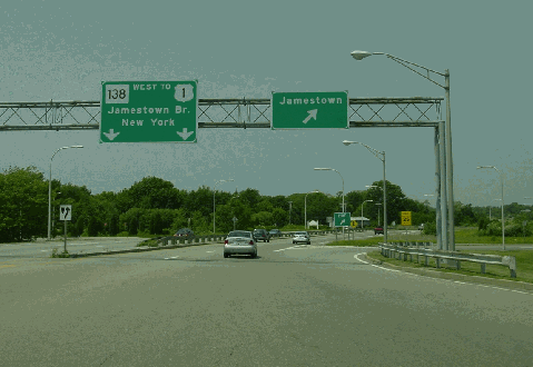
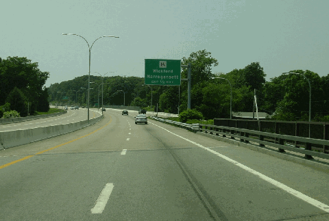
This 2002 photo shows the westbound RI 138 Expressway at the exit for East Shore Drive in Jamestown. This exit is located just west of the toll plaza for the Claiborne Pell (Newport) Bridge. (Photo by Jim K. Georges.) |
||
|
A NEW ROUTE 138, FINANCED BY I-895 TRADE-IN FUNDS: Almost immediately after I-895 was cancelled, the RIDOT used I-895 trade-in funds to begin design work on a new four-lane Jamestown Bridge that met Interstate design standards. The RIDOT selected consulting engineers to design two alternative bridge designs - one for a concrete bridge and one for a steel bridge - in compliance with Federal guidelines. The final design of the new Jamestown-Verrazano Bridge was approved in 1984, and construction began the following year. The $161 million bridge was opened to traffic on October 8, 1992. |
||
|
West of the new bridge in North Kingstown, work began in 1989 on upgrading the existing RI 138 between US 1 and the bridge to a four-lane divided freeway. To minimize the environmental impact, the footprint of the new RI 138 was reduced to a 200-foot-wide right-of-way, with the remaining 100 feet reserved for a greenway buffer. There was only a single carriageway separated by eight-foot-wide left shoulders and a concrete ("Jersey") barrier, foregoing original plans for a wide grassy median. (The original 1969 construction used a four-lane roadway with wide grassy median in the immediate area of the US 1 interchange, before RI 138 narrowed to a "super-2" just east of there.) The reduced-footprint design of the expanded RI 138 was similar to that of the Woonsocket Industrial Highway (RI 99) that also was built around this time, and thus required a lower speed limit of 50 MPH. |
||
|
This 2002 photo shows the westbound RI 138 Expressway coming off the Jamestown-Verrazano Bridge in North Kingstown. Note the ramp and lightposts on the right of the picture. This was the temporary ramp that the RIDOT built for carry vehicles between the RI 138 Expressway and the old Jamestown Bridge; this ramp was used in 1991-1992 before the new span opened. (Photo by Jim K. Georges.) |
||

|
TRADING IN I-895 FUNDS FOR LOCAL IMPROVEMENTS: In addition to the new Jamestown-Verrazano Bridge and the expressway approaches to the immediate west and east, the RIDOT submitted the following substitute plans for the I-895 corridor in the early 1980s: |
||
|
In 1993, the RIDOT shelved plans to relocated RI 138 arterial west of US 1, citing it would have been "impossible" to obtain the proper environmental permits. However, with the downsizing of the Navy's operations on Aquidneck Island, plans for a controlled-access alternative along Burma Road have been re-adopted for a "parkway" design similar to that on the RI 138 Expressway through Jamestown. More recent efforts have focused on building a bikeway along the Burma Road corridor and adding more bus service, but chronic congestion and roadway deterioration along RI 114 (West Main Road) and existing RI 138 (East Main Road) may yet force RIDOT to reconsider a new highway through Aquidneck Island. |
||
|
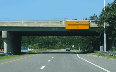
This 2006 photo shows the terminus of the westbound RI 138 Expressway at US 1 in North Kingstown. Note the unused stub extending west of the exit ramp for southbound US 1. (Photo by Steve Anderson.) |
||

|
INTRODUCING THE NARRAGANSETT TURNPIKE: The once-proposed I-895 from I-95 in Washington County to the MA 24 / I-195 interchange in Fall River should be built as a new toll road known as the Narragansett Turnpike. The new turnpike would comprise the existing Pell-Newport and Jamestown-Verrazano bridges, as well as existing sections of the RI 24 / MA 24 and RI 138 expressways. New expressway sections would be built through Washington County and Aquidneck Island. |
||


|
SOURCES: "New England Road Project Backed," The New York Times (10/29/1953); "New England South Shore Highway," Interstate Study Committee (1953); "Narragansett Bay East Passage Crossing: Preliminary Engineering and Economic Report," Rhode Island Department of Public Works (1955); "Traffic and Highway Study for East Providence, Barrington, Warren and Bristol, Rhode Island," Wilbur Smith and Associates (1955); "Rhode Island Roads," Rhode Island Department of Public Works (1956); "A Highway Program for Rhode Island," Rhode Island Department of Public Works (1959); "East Shore Expressway," Rhode Island Department of Public Works (1966); "Proposed Interstate System Adjustment," Rhode Island Department of Public Works and Massachusetts Department of Public Works (1968); "The Interstate Highway System in Rhode Island: A Force for Change in Rhode Island" by Dieter Hammerschlag, Brian K. Barber and J. Michael Everett, University of Rhode Island (1976); "Interstate 895: Final Environmental Impact and Section 4(f) Statement," Federal Highway Administration and Rhode Island Department of Transportation (1984); "North Kingstown, Exeter Join To Get Route 138 Access Road" by Barbara Davis, The Providence Journal (4/22/1986); "State Route 138: Final Environmental Impact and Section 4(f) Statement," Federal Highway Administration and Rhode Island Department of Transportation (1987); "Review of the Jamestown-Verrazano Bridge," Office of the Attorney General, State of Rhode Island (1990); "Ex-Foe To Take on DOT Again; State Denies Reviving Plans for Route 895" by Stephen Heffner, The Providence Journal (10/03/1992); "Transportation 2010: Ground Transportation Plan," Rhode Island Department of Transportation (1992); "After 20 Years, DOT Gives Up Fight for New Highway" by Stephen Heffner, The Providence Journal (11/19/1993); "Foes Seek To Stymie Jamestown Expressway" by Stephen Heffner, The Providence Journal (2/10/1994); Steve Alpert; Michael Kendricks; Scott Oglesby; Alexander Svirsky. |
||
|
RI 138 EXPRESSWAY LINKS: |
||
|
RI 138 EXPRESSWAY CURRENT CONDITIONS: |
||

|
OFF-SITE EXIT LISTINGS: |
||
|
VIEW OR SUBMIT YOUR RATING TO RATETHEROADS.COM: |
||

|
Claiborne Pell (Newport) Bridge (RI 138) Sakonnet River Bridge (RI 24 and RI 138) |
||

|
|
||
|
Site contents © by Eastern Roads. This is not an official site run by a government agency. Recommendations provided on this site are strictly those of the author and contributors, not of any government or corporate entity. |
||