
|
|
||
|
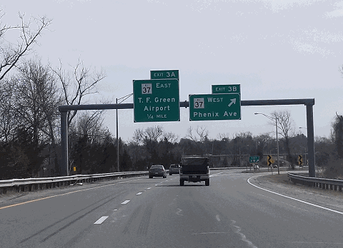
This 2018 photo shows the southbound Interstate 295 approaching EXIT 3 (RI 37 Expressway) in Cranston. This was the only exit whose numbering was not changed by RIDOT's 2017 milepost-based exit numbering program on I-295. (Photo by Steve Anderson.) |
||
|
Length: |
||
|
23.5 miles (37.8 kilometers) |
||

|
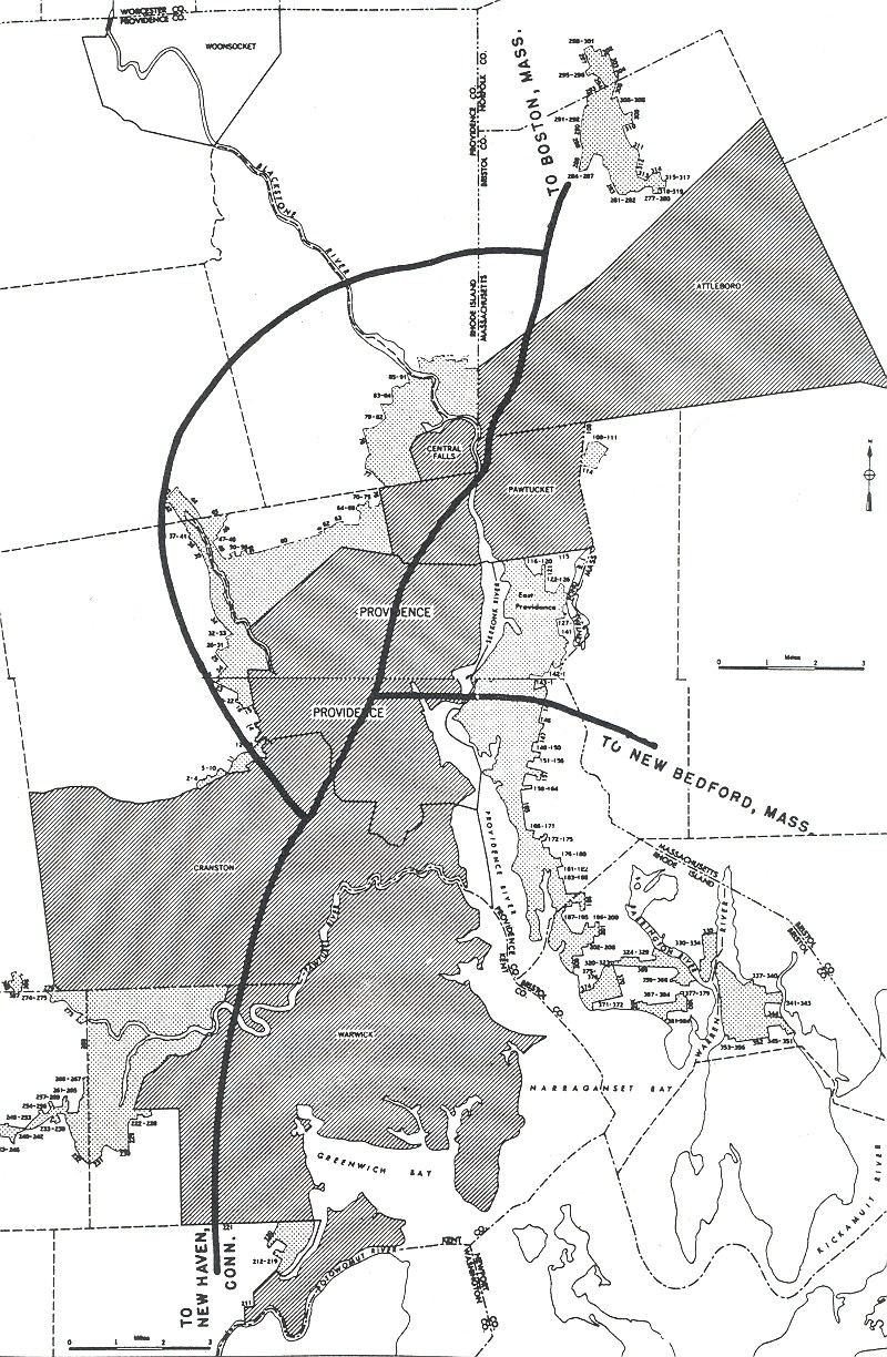
THE PROVIDENCE BELTWAY: In 1947, the Rhode Island Department of Public Works (RIDPW) devised plans for a freeway system for the Providence-Pawtucket metropolitan area. The initial proposal called for the construction of "Relocated US 1" (I-95) and "Relocated US 6" (I-195) - two freeways that were in the Federal-aid highway program - but did not include plans for a beltway. |
||
|
During the mid-1950s, Governor Dennis J. Roberts convened a "Governor's Highway Safety Committee" comprised of RIDPW and economic development officials. The committee's report, "Rhode Island Roads," introduced plans for a "Relocated Route 5" beltway from Warwick to Pawtucket. The state submitted the beltway to the Federal Bureau of Public Roads (BPR) for inclusion in the Federal-aid highway program. In 1955, the BPR included the beltway in the Interstate highway system, but with some changes. The freeway was to be constructed along a longer route via the RI 5 and RI 116 corridors, and be extended into Attleboro, Massachusetts, providing a complete bypass of the congested Providence-Pawtucket area. |
||
|
The route of I-295 through mostly undeveloped land attracted potential developers, and some of these developers (with the cooperation of planning boards) tried to take advantage of this situation. In 1962, the RIDPW announced the tentative route for I-295, but did not provide specific alignment information. Soon thereafter, the planning commission in Cranston approved a 108-home subdivision in the general path of I-295. The developer of the Cranston subdivision eventually sold his land to the RIDPW, but not before profiting handsomely. |
||
|
Right-of-way acquisition and design work began in 1964, and construction began one year later. The different sections of I-295 were completed in the following order: |
||
|
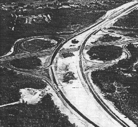
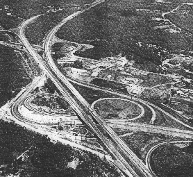
LEFT: This 1971 photo shows I-295 looking north and east at EXIT 18 (RI 146 Expressway) in Lincoln. Work continues on the unfinished I-295 south of this interchange in the foreground. RIGHT: This 1976 photo shows I-295 looking north at EXIT 9 (US 6 / Dennis J. Roberts Expressway) in Johnson. Note the incomplete ramps that were to connect to I-84, which was to continue west of this interchange toward Hartford. (Photos by Rhode Island Department of Transportation.) |
||
|
According to the Rhode Island Department of Transportation (RIDOT), I-295 carries approximately 40,000 vehicles per day (AADT). This compares with average volumes of 15,000 to 20,000 vehicles per day when I-295 was completed in the mid-1970s. Even with this increase in traffic, much of the development potential along I-295 remains unfulfilled. |
||
|
IMPROVEMENTS TO I-295: In 1999, the RIDOT released plans for a new EXIT 4A (Scituate Avenue) in Johnston. The new interchange, in conjunction with the widening of Scituate Avenue and Shun Pike, will provide improved access to a nearby landfill while keeping heavy trucks off local streets. It will also require the location of three families and five businesses. |
||
|
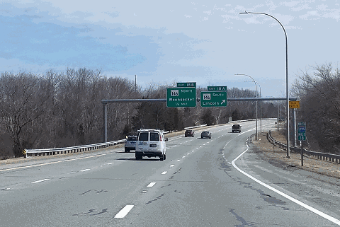
This 2018 photo shows the northbound I-295 at EXIT 18 (RI 146 Expressway) in Lincoln. This interchange was renumbered from EXIT 9 in 2017. (Photo by Steve Anderson.) |
||

|
SOURCES: "Rhode Island Roads," Rhode Island Department of Public Works (1956); "Industrial Development and Highway Planning in Rhode Island," Arthur D. Little, Inc. (1959); "A Highway Program for Rhode Island," Rhode Island Department of Public Works (1959); "The Interstate Highway System in Rhode Island: A Force for Change in Rhode Island" by Dieter Hammerschlag, Brian K. Barber and J. Michael Everett, University of Rhode Island (1976); "Record of Decision: Improved Highway Access to the Environmental Management District, Johnston and Cranston, Rhode Island," Federal Highway Administration and Rhode Island Department of Transportation (1999); "On Route 295, Rhode Island Will Join World of Rest Stop Retailing" by Edward Ortiz, The Providence Journal (12/03/2003); "Member and Firm News," Currents-AIA Rhode Island (January 2006); "RIDOT To Renumber I-295 Exits" by Sarah Doiron, WPRI-TV (9/22/2017); Surface Transportation Policy Project; Michael Kendricks; Douglas Kerr; Dan Moraseski; Chris O'Leary; Alexander Svirsky. |
||

|
INTERSTATE 295 LINKS: |
||
|
INTERSTATE 295 (RHODE ISLAND) CURRENT TRAFFIC MAPS: |
||
|
INTERSTATE 295 (RHODE ISLAND) VIDEOS: |
||

|
THE EXITS OF METRO BOSTON: |
||

|
Back to The Roads of Metro Boston home page. |
||
|
Site contents © by Eastern Roads. This is not an official site run by a government agency. Recommendations provided on this site are strictly those of the author and contributors, not of any government or corporate entity. |
||