This 2004 photo shows the eastbound Worcester Expressway (I-290) at EXITS 13 (MA 122A / Vernon Street) in Worcester. (Photo by Jim K. Georges.)
THE WORCESTER LOOP: Planning for the Worcester Expressway began as early as 1951, when the Massachusetts Department of Public Works (MassDPW) included a proposed loop route from Auburn to Hopkinton via Worcester. Both ends of the loop were to connect to what was to eventually become the Massachusetts Turnpike (I-90). The six-lane highway, which was originally designated MA 122A, was expected to cost $37 million in its entirety. It was designed to carry 34,000 vehicles per day (AADT), and according to The Worcester Telegram, was "projected to cover the city's traffic needs through 1975."
In 1955, the Federal Bureau of Public Roads (BPR) included the "Worcester Loop" as part of the preliminary Interstate highway network. One year later, the route became part of the MassDPW and BPR Interstate network, making the route eligible for 90 percent Federal financing of the (now) $40 million cost.
RUNNING INTO OPPOSITION: It did not take long for opposition to the Worcester Expressway to surface. What started off as a stirring of opposition among Millbury Street merchants during 1956 grew to an increasingly hostile chorus among East Side residents during 1957, when state Public Works Commissioner Carl Sheridan announced that the state would build the road east of Harding Street, and begin land takings later that year. One businessman called the proposed expressway "a skyway" that The Worcester City Council was presented with 48 separate petitions denouncing the state plan, and even asking for the resignation of Sheridan.
However, the decision was not the city's to make, and on July 10, 1957, Sheridan gave the final go-ahead for the project. Among the properties slated for condemnation were two schools, three synagogues, two ethnic social clubs, a fire station, the Worcester State Hospital, and the old Union Station clock tower.
This photo from the mid-1960's shows the eastbound Worcester Expressway (I-290) at the same location as the photo above. Note the steel guiderails that were replaced by a concrete "Jersey" barrier in later years. (Photo by Jim K. Georges.)
FIRST SECTIONS OPEN: Construction of a one-mile-long elevated section of I-290 in the area of Washington Square began in late 1958. On September 30, 1960, the MassDPW opened this section. The state estimated that approximately 11,000 vehicles used the new section the first day. By late 1961, the Worcester Expressway was completed from Posner Square to Brosnihan Square; it handled approximately 21,000 vehicles per day (AADT).
SPARING HOLY CROSS: Meanwhile, opposition surfaced along the then-unbuilt section from College Square south toward Auburn. The conflict arose in 1961 when the MassDPW abandoned plans to take nine acres of Holy Cross property (including Fitton Field), but approved an alternate plan that would displace 24 neighborhood businesses. Unlike the original plan, which faced nearly no opposition (save from some Holy Cross officials who feared drastic revisions to the school's master plan), the revised I-290 route plan received near-unanimous opposition. The opposition even cited a state study that the route through Fitton Field would be less expensive. However, the public outcry did not sway state officials, who decided to spare Holy Cross after all. State officials even reversed their position on the cost, stating that it would cost an additional $1.5 million to build I-290 through Fitton Field.
By the time the plans through College Hill were finalized in November 1962, the MassDPW already was acquiring right-of-way south to the Massachusetts Turnpike. The route change resulted in a tight curve in the area of College Hill.
REVISING PLANS FOR I-290: When it was first proposed, the eastern terminus of I-290 was to be at the intersection of the Massachusetts Turnpike (I-90) and the Outer Circumferential Highway (I-495) in Hopkinton. By 1965, the MassDPW shifted the alignment of the Worcester Expressway north through Shrewsbury and Northborough, terminating at a cloverleaf interchange with I-495 in Marlborough. At the cloverleaf, the state made provisions for a future extension of I-290 east of I-495.
To the southwest, the MassDPW re-designed the Auburn terminus of I-290 to permit access to not only the Massachusetts Turnpike (I-90), but also the proposed MA 52 Expressway (now known as I-395). To accommodate the additional capacity, the state revised the plans for I-290 through Auburn from four lanes to six lanes.
CONSTRUCTION TRAGEDY: In April 1968, a bridge being built to carry I-290 over Southbridge Street in Worcester collapsed, killing three construction workers and injuring eight. According to news reports, only one end of the steel girders had been attached to the concrete abutment. However, John F. Gallagher, a former engineer with the MassDPW, said this type of construction is standard procedure to prevent expansion and contraction of the beams from ripping out the bolts. An inquiry into the accident failed to find a specific cause, and ruled out negligence.
COMPLETING THE LOOP: In September 1968, five months after the construction accident in Worcester, the six-lane I-290 extension from Brosnihan Square south to the Massachusetts Turnpike in Auburn was opened to traffic. The expressway now was open through Auburn and Worcester. Two years later, the six-lane eastern extension of I-290 to Marlborough was opened to traffic. The final cost of the 20-mile-long loop was $50 million. When it opened in 1970, the Worcester Expressway was designed to carry approximately 70,000 vehicles per day.
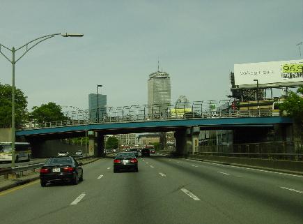
This 2002 photo shows the eastbound Worcester Expressway (I-290) at EXITS 19-20 (I-190 / MA 12 / MA 70) in Worcester. Built in the early 1970's, this interchange did not open fully until 1983 when I-190 was completed. (Photo by Jim K. Georges.)
A MUCH-TROUBLED ROUTE: Designed in the early days of the Interstate program, I-290 suffers from an excessive amount of entrance and exit ramps, and a lack of shoulders along the elevated section through Worcester. The popularity of highway among motorists seeking a toll-free alternative between I-90 and I-495, combined with high speeds has been a lethal mix. In 1987, the state imposed a 50 MPH speed limit on I-290 through downtown Worcester.
Even the lights along I-290 did not operate for many years. In 1975, before all the lights were installed, the state ordered the lights shut off to save money. During the next several years, the state found that the many of the lights did not work due to burned-out bulbs, wiring problems, and even rodents. A 1979 repair project was shelved due to a lack of funds; the lights were not fixed until 1988. Most of the light standards and wiring were replaced completely in the mid-to-late 2000's.
As the section of I-290 through urban Worcester neared the half-century mark, the Massachusetts Highway Department (MHD) embarked in 2004 on a three-year project to replace the deck on a 1,550-foot-long elevated section through downtown Worcester. One-by-one, each lane was removed and rebuilt, reducing roadway capacity to two lanes in each direction through the construction zone during peak construction season. A movable barrier was used to separate traffic flows during construction. The construction required ramp closures at EXIT 14 (Grafton Street), EXIT 15 (Shrewsbury Street) and EXIT 16. Upon the conclusion of the $16 million project in 2007, new landscaping was planted along the elevated highway.
CHANGES FOR INTERCHANGES: Over the years, the state made the following improvements to interchanges on the Worcester Expressway:
EXIT 26 (I-495) in Marlborough: The MassDPW replaced the existing eastbound I-290 loop ramp to northbound I-495 with a left-exit flyover ramp in 1978. (Rock cuts reveal the location of the original cloverleaf ramp.) That same year, the state also built a connector east from I-495 to MA 85 in Hudson along the right-of-way of what was to be the I-290 Both projects were completed in 1978. EXIT 26 (I-495 / Outer Circumferential Highway): In 2000, the MHD installed large warning signs to inform motorists of the ramp connecting eastbound I-290 to northbound I-495. The curved one-lane ramp, whose sight distance is compromised by the geography of the area, has been the site of many accidents over the years. The MHD also installed continuous fluorescent lighting on top of the concrete ("Jersey") barrier guardrail, improving nighttime visibility on that dangerous ramp. A complete re-design of the interchange, in which the geometry (specifically, the curve radii) of the ramps would be improved, is years away, and is expected to cost $30 million.
EXITS 19-20 (I-190 / MA 12 / MA 70) in Worcester: The MassDPW opened ramps and bridge connecting to the newly completed I-190, providing a connection to Leominster and points north. The interchange ramps were built in the early 1970's, but the connecting expressway did not open until 1983.
EXIT 12 (MA 146 / Brosnihan Square) in Worcester: To accommodate the extension of the MA 146 Expressway (Worcester-Providence Turnpike), the MHD rebuilt this exit as a partial "trumpet" interchange to permit movement from northbound MA 146 to westbound I-290, and from eastbound I-290 to southbound MA 146. Part of the $290 million project to reconstruct MA 146, the interchange project included capacity improvements to I-290 in the area of EXIT 12. The $60 million final leg of the MA 146 Expressway was opened to traffic in November 2007, though additional ramp work at Brosnihan Square is expected to continue through 2009.
According to the Massachusetts Highway Department (MHD), I-290 carries now approximately 90,000 vehicles per day through Auburn, rising to approximately 125,000 vehicles per day through downtown Worcester, and falling back to approximately 60,000 vehicles per day near the eastern terminus in Marlborough.
This 2002 photo shows the eastbound I-290 at EXIT 26 (I-495 / Outer Circumferential Highway) in Marlborough. The route continues east of I-495 as the Hudson Connector to MA 85. (Photo by Jim K. Georges.)
EXTENDING TO ROUTE 128: In 1968, the MassDPW released its Recommended Highway and Transit Plan, outlining large-scale capital improvements through 1990. The I-290 extension from I-495 (Outer Circumferential Highway) in Marlborough to MA 128 (Yankee Division Highway) in Waltham, included in the master plan as the free "Western Expressway," was intended to relieve congestion and serve local traffic in the rapidly expanding suburbs along the US 20 corridor.
The MassDPW stated the purpose for the I-290 extension as follows:
The Western Expressway, a continuation from I-290 at I-495 in Marlborough to MA 128 in Waltham, would provide a second continuous routing from MA 128 to the west. It would provide access to the fastest growing part of the corridor, and to the residential and industrial complexes that are expected to develop around I-495 in the Hudson-Marlborough area. This accessibility would allow workers to live some distance from these new plants and still commute in a reasonable time. Even though the Western Expressway and the Massachusetts Turnpike are closer together than freeway spacing criteria normally recommend, the fact that one is a toll road makes the spacing acceptable.
However, the report did not recommend extending the expressway east of MA 128:
The eastern terminus of the Western Expressway puts an additional strain on MA 128, which will be operating at or above capacity. To counteract the disadvantage of a "T" intersection of expressways, it is desirable to have arterial routes continuing from the intersection. In this instance, US 20 and the Western Expressway join just west of MA 128, and there will be an opportunity to continue on US 20 east of MA 128. US 20 passes through the heart of Waltham, however, and its capacity to handle large volumes of traffic is limited by traffic signals and parked vehicles. Nevertheless, the radial travel demand inside MA 128 is not of sufficient magnitude, when measured against community disruption, to require the continuation of this expressway. Substantial traffic engineering improvements to US 20 would be required to handle any additional traffic that the Western Expressway would generate.
The I-290 extension was expected to handle approximately 35,000 vehicles per day (AADT) near I-495, rising to 110,000 vehicles per day near MA 128.
TWO ALTERNATIVES FOR EXTENDING I-290: Two years later, in 1970, the MassDPW developed the following two alternative alternatives for extending I-290 east of I-495:
SOUTHERN ALIGNMENT: Similar to the 1968 alignment in the
Recommended Highway and Transit Plan, I-290 was to have been routed along the US 20 corridor through Marlborough, Sudbury, Wayland, Weston and Waltham, terminating at MA 128 (Yankee Division Highway) at the current EXIT 26 in Waltham. Additional improvements would have been required along MA 128 (I-95) to handle the project traffic. The 17.5-mile-long extension was expected to cost $45 million, and would have required the displacement of 120 homes and ten businesses.
NORTHERN ALIGNMENT: Introduced for the first time in the 1970 location report, this alignment would have extended through Marlborough, Hudson, Stow, Maynard, Sudbury and Concord, terminating at a proposed extension of the MA 2 (Western) Expressway in Concord. Planned improvements along the MA 2 corridor would have provided for the additional traffic generated by the I-290 extension. The 14.0-mile-long extension was expected to cost $29 million, and would have required the displacement of 83 homes and one business.
Both alignments were to have had six 12-foot-wide travel lanes (three in each direction), two 10-foot-wide outer shoulders and two 4-foot-wide inner shoulders. Rural sections were to have been constructed with a variable median containing natural vegetation. Along urban sections (planned only for the southern alignment), the roadways were to have been constructed on an embankment, separated by a ten-foot-wide median, and flanked on either side by two-lane service roads.
The battle over the Worcester Expressway extension continued through the early 1970's, with the towns along the I-290 route trying to get the Massachusetts Legislature to kill the plan. By the mid-1970's, the MassDPW killed the I-290 extension.
After the cancellation, Digital Equipment Corporation acquired a section of the I-290 extension right-of-way from the MassDPW for access to its new Hudson plant. A 1.5-mile-long connector to the plant and nearby MA 85, which is not officially part of I-290, opened in 1978. (The plant was sold by Compaq - the successor to Digital Equipment - to Intel in 1998.)
This 2008 photo shows the eastbound Hudson Connector extending from the I-290 / I-495 interchange in Marlborough to MA 85 in Hudson. (Photo by Steve Anderson.)
The interchange at EXIT 26 (I-495 / Outer Circumferential Highway) in Marlborough should be rebuilt to permit two-lane, high-speed ramps with improved geometry.
SOURCES: Master Highway Plan for Worcester, Massachusetts Department of Public Works (1951); "A Report of Progress," Massachusetts Department of Public Works (1962); "Interstate Route 290: Worcester-Auburn," Massachusetts Department of Public Works (1962); "Central Corridor Traffic Study," Massachusetts Department of Public Works (1965); Recommended Highway and Transit Plan, Massachusetts Department of Public Works (1968); "The Massachusetts Highway Story," Massachusetts Department of Public Works (1969); "Location Report: I-290 Extension," Massachusetts Department of Public Works (1970); "Kings of the Road" by Ruth Trask, WPI Journal-Worcester Institute of Technology (July 1998); "Danger Foreseen at I-290 / I-495 Interchange" by Elaine Thompson, The Worcester Telegram and Gazette (1/21/2000); "Fabled Route 128 at Heart of New England High Tech" by Richard Bruner, Semiconductor Magazine (June 2001); "Highway from Hell" by Noah Schaffer, Worcester Magazine (3/20/2003); "A Dodge-'em Full of Maniacs" by Michael Warshaw, Worcester Magazine (3/20/2003); "The Big Snarl: Project Will Divert Some I-290 Traffic" by Martin Luttrell, The Worcester Telegram and Gazette (4/11/2004); "Revamping the Ramps" by Kevin Keegan, The Worcester Telegram and Gazette (6/23/2006); "I-290 Span Reinforcement Nears End" by Priyanka Dayal, The Worcester Telegram and Gazette (8/12/2007); Massachusetts Highway Department; Worcester Regional Research Bureau; George Allegreza; William Louis Herbert; David Jackino; Dan Moraseski; Peter Nersesian; Scott Oglesby; Paul Schlichtman; Alexander Svirsky.
I-290 shield by Ralph Herman. Lightposts by Millerbernd Manufacturing Company.